The one where I turn my CV into a web map ….
The end of the MSc at Edinburgh is in sight, so as I start work on the dissertation it is time also to turn my attention to finding a job afterwards! In search of ways to stand out from the crowd while also showcasing my newfound skills, I hit upon my latest project – MapMyCV. That’s right, I’ve turned my CV into a web map!
The map uses the same Python Folium library that I used to make the web map for the Capital Greenspace Project. However, this time I couldn’t host it on the university Linux servers, so I needed an alternative that would still allow me to connect to a database holding all the details I wanted to display. Sounds like an ideal task for the Django framework, which luckily I completed a Coursera specialisation in last summer, and the free PythonAnywhere hosting service.
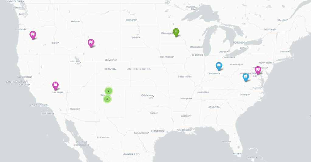
I categorised experiences into four groups – education, employment, fieldwork, and miscellaneous. Each category is represented as a separate layer on the map that can be turned on or off, and each entry within a category is shown with a coloured marker. Clicking on any marker reveals a pop-up window with details about that entry. Those categories and entry details are drawn from a SQLite database that is built into the Django framework.
Clearly a web map makes it difficult to display data in temporal order, as a traditional CV does (not that this is intended to replace such a document). However, I am thinking of ways to incorporate that temporal aspect – possibly as a geologic column graphic! In the meantime it would be great if you took a look and let me know what you think – and of course if you know anyone looking to hire a geospatial professional you know where to send them!
